Hiking and getting lost, and the 51 hours that decide most searches
Key takeaways · 10 min read
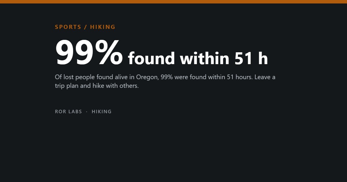
- In Oregon, 99% of people found alive were found within 51 hours of being reported missing, so the clock starts when someone notices you are gone.
- Half of lost hikers in temperate mountains were found within 2.4 kilometres of where they were last known to be, and nine in ten within 10 kilometres.
- People lost alone did far worse: in Oregon 14.9% died, against 2.2% of those lost in a group.
- Phones can send a location accurate to within 50 metres, but 74% of lost Australians who carried one had no reception.
In June 2024 a 34-year-old man set out on what he expected to be a three-hour hike in the Santa Cruz Mountains of California. He carried a torch and a pair of folding scissors, and he told nobody where he was going. His family reported him missing several days after he left. He drank from creeks, slept on wet leaves and was found after ten days, when someone heard him shouting and a fire department drone and a search dog led rescuers to him.
He was lucky in a way the numbers explain. In an analysis of Oregon search missions from 1997 to 2003, 99% of the people found alive were found within 51 hours of being reported missing. Rescue teams are busier than ever: Mountain Rescue England and Wales recorded 3,968 call-outs in 2025, up from 3,784 the year before, and Scottish teams assisted 901 people.
This article covers what actually happens when hikers get lost, how far they go and how often they are found alive, where the risk concentrates, what phones, beacons and trip plans have been measured to do, and why the lesson is to hike carefully rather than to stay at home. It draws on search records from Oregon, Scotland, Australia and an international incident database.
What actually happens when hikers get lost
Most episodes of being lost are brief and end without anyone else knowing. In a Norwegian survey of 693 outdoor users, 62% said they had lost their way at some point. Of those who could remember how long it lasted, 42% said a few minutes and 46% said half an hour to an hour. The cases that reach search teams are the minority that do not resolve themselves, often because night falls, someone is hurt, or the person keeps walking the wrong way.
For those cases, search planners lean on the International Search and Rescue Incident Database, compiled by the search researcher Robert Koester, which grew from about 50,700 incidents to almost 144,000 by 2016. Analysed for 1,154 searches for hikers in temperate mountains, it shows that half were found within 2.4 kilometres of the point where they were last seen or known to be, and nine in ten within 10 kilometres. Half had been on the move for five hours or less.
How far lost hikers are found from where they were last seen
Straight-line distance from the initial planning point within which each share of hikers was found. Searches for hikers in temperate, mountainous terrain, International Search and Rescue Incident Database (ISRID 2.0), 1,154 cases.
Source: Drexel, Zimmermann-Janschitz & Koester, International Journal of Emergency Services 7(3) (2018), Table II. The search area roughly doubles with each extra 10% of probability.
The outcome of a search is usually good. Oregon’s state search database, covering 1997 to 2013, logged almost 7,500 lost people: 88% were found alive, 8% were found dead and 3% were never found. More than a quarter, 27%, found their own way out while the search was under way. In the earlier Oregon analysis, time was the most important variable in whether someone was found alive, more than age or the weather.
Where the risk concentrates

Going alone is the clearest risk factor in the records. In Oregon’s database, people lost on their own were found alive 79% of the time, against 97% for people lost in a group; 14.9% of solo subjects died, compared with 2.2% of those in groups, and solo subjects were also more likely never to be found. Put together, solo subjects were roughly seven times as likely to die or go missing. A companion can go for help, keep someone warm, or simply be another pair of eyes on the map.
Navigation problems are the second cluster. As our earlier article on hiking and mountaineering deaths showed, falls and medical events dominate the deaths; getting lost is about the hours and nights in between. In Scotland in 2025, hillwalkers made up 94% of mountaineering incidents. Among the contributory factors teams recorded, being lost was cited 60 times and a navigation error 47 times, close behind medical problems and well behind the commonest single factor, a slip or trip.
Why Scottish mountain rescue teams were called out
Contributory factors recorded in 491 mountaineering incidents in Scotland in 2025. An incident can have more than one factor; selected factors shown.
Source: Scottish Mountain Rescue, Statistics Report 2025.
The pattern in England and Wales is similar. Mountain Rescue England and Wales data for 2024, mapped by Ordnance Survey, showed that 78% of call-outs came after midday, 17% were searches for missing people and 8% were for people who rang in to say they were lost. Walkers aged 18 to 24 had become the most rescued age group, a shift the mapping agency linked partly to phone apps without enough detail for remote ground.
Lost alone or lost with others
Outcomes of people lost or missing in Oregon search and rescue missions, by whether they were alone or in a group, 1997–2013.
Source: Oregon Office of Emergency Management, Oregon SAR accumulated totals, 1997–2013. Observational data; solo subjects also differ in age, health and activity.
Australia adds a behavioural detail. In a survey of 87 people who had been lost in the bush, 66% left the track once they realised they were lost, and men were more likely to do so than women. The national search manual the authors cite reports that 48% of lost people are found on a track. Leaving it to take a shortcut back is a natural impulse that makes a searcher’s job harder.
What has been measured to work

The single most useful thing is for someone to know where you have gone and when you will be back. A search cannot start until somebody notices you are missing, and every hour of delay widens the area to be searched. The Santa Cruz hiker told nobody, so the search began days late. Nobody has run a trial of trip plans, but the arithmetic of the Oregon survival window and the ISRID distances makes the case on its own.
Phones help most when they can reach a network. When a modern smartphone calls the emergency number, Advanced Mobile Location sends its satellite or Wi-Fi position automatically. Irish regulator data for 2022 showed that 95.1% of the satellite fixes were accurate to within 50 metres. But coverage fails where people get lost: in the Australian survey, 83% had a phone with them, and 74% of those had no reception.
What a phone can and cannot do when you are lost
Shares from two sources: emergency calls in Ireland (2022 accuracy data) and a survey of people who had been lost in the Australian bush.
Sources: ComReg (Commission for Communications Regulation), enhanced caller location presentation, BEREC (2024); Dacey, Whitsed & Gonzalez, Australian Journal of Emergency Management 38(2):29 (2023).
Personal locator beacons and satellite messengers work where phones do not. A 406 MHz beacon sends a distress signal to satellites, which pass the position to a rescue coordination centre. In 2024, NOAA said, the system helped rescue 411 people in the United States and its waters, 52 of them on land. Registering the beacon lets rescuers know who is calling and what help is likely needed.
The evidence that these devices save lives on land is, however, thinner than the marketing. We could not find a study measuring survival or search time in hikers who carried a beacon against those who did not. A survey of 235 overnight visitors to a Californian wilderness found that 55% felt technology made them safer and would be more willing to use it to request rescue. Scottish teams now record reliance on technology as a factor of its own, rising over the long term, though their report says it does not collect the data to show how connectivity is changing incidents.
Why the answer is not to stop hiking

Getting lost is common and usually harmless; dying of it is rare. Nine in ten Oregon search subjects were found alive, and most people who lose their way never need searchers at all. The goal is to shorten the dangerous tail: the night out without warm clothes, the solo walker nobody has missed, the long march in the wrong direction. Most of what shortens it costs little or nothing.
A recent New Hampshire rescue shows how ordinary the failures are. In August 2026 four 18-year-olds started a strenuous ridge walk in the White Mountains at 3.30pm, without headlamps, warm clothes or enough water. They called for help about five hours in and were guided out overnight. The state bills hikers it judges negligent: roughly 12 of about 180 rescues a year, typically $1,000 to $20,000. A $25 Hike Safe card protects holders who were not negligent or reckless.
How people found their way again
How 283 people who had been temporarily lost outdoors described getting their bearings back. Survey mainly of Norwegian outdoor users; a description could fall into more than one category.
Source: Wattne & Volden, Journal of Navigation (2024), doi:10.1017/S0373463324000067. Self-reported recollections, not observed behaviour.
The practical list follows from the data. Leave a route and a return time with someone who will act on it. Walk with others when you can. Carry a charged phone and a power bank, download the map before you lose signal, and carry a paper map and compass you know how to use. Start early enough to finish in daylight, and pack a headlamp and a warm layer. If you are truly lost, stop, stay on or near a track and call the emergency number; beyond phone coverage, a registered beacon is the backstop.
What to do
Steps sorted by when they matter. Each one says how strong the evidence is: Measured Official advice Untested
Before
- Leave your route and return time with someone who will act on it. In Oregon, 99% of people found alive were found within 51 hours of being reported missing. Measured see Sources
- Walk with others when you can. In Oregon, 14.9% of people lost alone died, against 2.2% of those lost in a group. Measured see Sources
- Download the map before you lose signal, and carry a paper map and compass you know how to use. Official advice see Sources
If it happens
- Start early enough to finish in daylight, and carry a headlamp and a warm layer. Official advice see Sources
- Carry a charged phone and a power bank. 74% of lost Australians who carried a phone had no reception, so do not rely on it alone. Measured see Sources
What not to do
- Do not leave the track to take a shortcut back once you realise you are lost. Official advice see Sources
Not safety-training advice. In an emergency call the local emergency number and ask for mountain rescue or search and rescue where that applies.
Questions people ask
Should you stay put if you are lost?
Staying put is the standard safety advice once you are truly lost, especially if someone knows your route. It keeps you inside the search area. In Australia 48% of lost people are found on a track, and two thirds of lost walkers surveyed there had left the track.
How long do searchers have to find someone alive?
There is no fixed deadline, but time matters most. In Oregon, 99% of people found alive were found within 51 hours of being reported missing. The researchers stressed this was not a reason to call off searches after 51 hours.
Is a phone enough, or do I need a beacon?
A phone is enough where there is coverage, and an emergency call can send a precise location automatically. In remote areas, three quarters of lost Australians with phones had no signal, which is where a beacon or satellite messenger helps.
Will I have to pay for my rescue?
It depends where. British mountain rescue teams are volunteer organisations; Scottish teams logged 39,229 volunteer hours on call-outs in 2025. New Hampshire can bill hikers it judges negligent, and sells a $25 Hike Safe card that protects holders who acted responsibly.
The short version
- In Oregon, 99% of people found alive were found within 51 hours of being reported missing, so the clock starts when someone notices you are gone.
- Half of lost hikers in temperate mountains were found within 2.4 kilometres of where they were last known to be, and nine in ten within 10 kilometres.
- People lost alone did far worse: in Oregon 14.9% died, against 2.2% of those lost in a group.
- Phones can send a location accurate to within 50 metres, but 74% of lost Australians who carried one had no reception.
- Leave a trip plan, walk with others, carry a map, light and charged phone, and if truly lost, stop and stay near the track.
This is a summary of published research and official statistics, not medical or safety-training advice. In an emergency, call the local emergency number (999 in the UK and Ireland, 112 in Europe, 911 in North America, 000 in Australia) and ask for mountain rescue or search and rescue where that applies. For injuries after a fall or a night out, see a doctor or physiotherapist, and consider a navigation course before tackling remote routes.
Further reading: Drexel, Zimmermann-Janschitz & Koester, International Journal of Emergency Services (2018), for how far lost hikers travel. Dacey, Whitsed & Gonzalez, Australian Journal of Emergency Management (2023), for how lost walkers behave. Scottish Mountain Rescue, Statistics Report 2025, for why teams are called out.
Sources
- KSBW via CNN Newsource. Missing hiker found alive after being lost for 10 days in mountains. Published by WAFB, 22 June 2024.
- Adams AL, Schmidt TA, Newgard CD, Federiuk CS, Christie M, Scorvo S, et al. Search is a time-critical event: when search and rescue missions may become futile. Wilderness & Environmental Medicine (2007); Oregon Health & Science University news release, 17 July 2007.
- Mountain Rescue England and Wales 2025 figures, as reported by Wrexham.com and Deeside.com, 31 March 2026.
- Scottish Mountain Rescue. Statistics Report 2025 (2026).
- Wattne OE, Volden F. Waylosing and wayfinding in the outdoors: a typology of wayfinding approaches to problem-solving when temporarily lost. Journal of Navigation (2024), doi:10.1017/S0373463324000067.
- Drexel S, Zimmermann-Janschitz S, Koester RJ. Network analysis for search areas in WiSAR operations. International Journal of Emergency Services 7(3) (2018), doi:10.1108/IJES-02-2017-0005.
- Koester RJ. Lost Person Behavior: A Search and Rescue Guide on Where to Look – for Land, Air and Water. dbS Productions (2008), as described by Drexel et al. (2018) and Wattne & Volden (2024).
- Oregon Military Department, Office of Emergency Management. Oregon SAR accumulated data, 1997–2013.
- Ordnance Survey. 18 to 24 biggest age group in need of rescuing (Mountain Rescue England and Wales 2024 data), 17 April 2025.
- Dacey K, Whitsed R, Gonzalez P. Understanding lost person behaviour in the Australian wilderness for search and rescue. Australian Journal of Emergency Management 38(2):29–35 (2023).
- Fox M (ComReg). Enhanced caller location for emergency calls. Presentation published by BEREC, April 2024.
- NOAA NESDIS. NOAA satellites were pivotal in the rescue of 411 lives in 2024, 27 January 2025; breakdown by sea, land and air as reported by Marine Insight, January 2025.
- Pope K, Martin SR. Visitor perceptions of technology, risk, and rescue in wilderness. International Journal of Wilderness (2011).
- Mayo Mountain Rescue callout, 5 January 2025. “Phonefind technology was key to Mayo rescue operation.” Western People, 10 January 2025.
- Hikers billed for rescue in New Hampshire. Boston Globe, 21 August 2026.
- New Hampshire Fish and Game Department. Be prepared for the unexpected: buy your 2025 Hike Safe card, 31 December 2024.