
Trend summary
- Earthquake risk does not trend year to year the way road deaths do. Most years are quiet; the losses arrive in rare, large events.
- 2026 so far: the largest US quake was a magnitude 6.5 in the Aleutian Islands on 17 September, deep and remote, with no damage expected.
- The more useful trend is exposure. The 2023 USGS hazard model says nearly 75% of the US could experience damaging shaking.
- USGS and FEMA estimate earthquakes cost the country about $14.7 billion a year on average in building damage and related losses.
What the numbers show
The USGS catalogue for 2026 lists a handful of magnitude 5.5+ events in US territory, almost all in Alaska. The ones people felt were smaller and closer to home: an M5.7 in western Nevada on 14 April, an M6.0 on Hawaii’s Big Island on 23 May and an M5.6 near Redwood Valley, California, on 24 June.
The long-run picture is set by the 2023 National Seismic Hazard Model, released in January 2024. It added nearly 500 faults, raised the hazard along the Atlantic corridor from Washington, DC, to Boston, and found that 37 states have had a magnitude 5+ quake in the past 200 years. A 2023 USGS–FEMA study put the average annual loss at $14.7 billion, double the earlier estimate, mostly on the West Coast.
What is driving it
Earthquakes are not becoming more frequent. What grows is the value and number of buildings in harm’s way, and our knowledge of faults. In a modern building, most injuries come from falling contents and unsecured furniture rather than collapse, which makes the risk partly manageable at home.
Recent cases
- 17 September 2026: M6.5, 177 km west of Nikolski, Alaska, at about 115 km depth. No tsunami was expected and USGS rated the likelihood of damage as low.
- 24 June 2026: M5.6 near Redwood Valley, Mendocino County, California, widely felt across Northern California.
Press releases and official reports, 2023–2026
Five key releases a year for the last four years, newest first. Most are from federal agencies; a few news reports are included where they are the clearest public record of an event. Releases from 2007–2022 are in the expandable list after 2023.
2026
- 17 Sep 2026USGSM 6.5 – 177 km W of Nikolski, Alaska (event page)
- 24 Jun 2026USGSM 5.6 – 11 km N of Redwood Valley, CA (event page)
- 23 May 2026USGSM 6.0 – 13 km S of Honaunau-Napoopoo, Hawaii (event page)
- 14 Apr 2026USGSM 5.7 – 20 km ESE of Silver Springs, Nevada (event page)
- 13 Jan 2026USGSUpdates for ShakeAlert False Alert for M5.9 Earthquake near Carson City, NV (Dec. 2025)
2025
- 6 Dec 2025USGSM 7.0 – 2025 Hubbard Glacier Earthquake (event page)
- 27 Nov 2025USGSM 6.0 – 12 km WNW of Susitna, Alaska (event page)
- 31 Jul 2025USGSUSGS releases aftershock forecast for M8.8 Russian Kamchatka Peninsula Earthquake
- 16 Jul 2025USGSM 7.3 – 2025 Sand Point, Alaska Earthquake (event page)
- 27 Feb 2025USGSPhase 1 technical implementation plan for the expansion of the ShakeAlert earthquake early warning system to Alaska
2024
- 19 Dec 2024USGSThe Night the Earth Shook
- 5 Dec 2024USGSM 7.0 – 2024 Offshore Cape Mendocino, California Earthquake (event page)
- 11 Apr 2024USGSUSGS deploys “aftershock kits” to study Whitehouse Station earthquakes
- 5 Apr 2024USGSM 4.8 – 2024 Tewksbury, New Jersey Earthquake (event page)
- 16 Jan 2024USGSNew USGS map shows where damaging earthquakes are most likely to occur in US
2023
- 21 Dec 2023USGSM 6.1 – 116 km SE of Adak, Alaska (event page)
- 16 Oct 2023USGSM 6.4 – 78 km NNW of Adak, Alaska (event page)
- 16 Jul 2023USGSM 7.2 – 2023 Sand Point, Alaska Earthquake (event page)
- 18 Apr 2023USGSNew USGS-FEMA study highlights economic earthquake risk in the United States
- 7 Mar 2023USGSEarthquake in Southern California 90 Years Ago Changed the Way We Build
View 20 years of major earthquake reports (2007–2026)80 more from 2007–2022, five a year, newest first
2022
- 20 Dec 2022USGSM 6.4 – 15km WSW of Ferndale, CA (event page)
- 16 Nov 2022USGSM 5.4 – Coalson Draw, Texas (event page)
- 25 Oct 2022USGSM 5.1 – 15km ESE of Alum Rock, CA (event page)
- 22 Jan 2022USGSM 6.2 – 71 km S of Unalaska, Alaska (event page)
- 11 Jan 2022USGSM 6.8 – 100 km SE of Nikolski, Alaska (event page)
2021
- 20 Dec 2021USGSM 6.2 – 7km N of Petrolia, CA (event page)
- 10 Oct 2021USGSM 6.2 – 27 km SSE of Naalehu, Hawaii (event page)
- 14 Aug 2021USGSM 6.9 – 125 km SE of Perryville, Alaska (event page)
- 29 Jul 2021USGSM 8.2 – 2021 Chignik, Alaska Earthquake (event page)
- 8 Jul 2021USGSM 6.0 – Antelope Valley, CA (event page)
2020
- 22 Jul 2020USGSM 7.8 – 2020 Perryville, Alaska Earthquake (event page)
- 15 May 2020USGSM 6.5 – Monte Cristo Range, NV Earthquake (event page)
- 31 Mar 2020USGSM 6.5 – Stanley, Idaho (event page)
- 18 Mar 2020USGSM 5.7 – 5 km NNE of Magna, Utah (event page)
- 7 Jan 2020USGSM 6.4 – 4 km SSE of Indios, Puerto Rico (event page)
2019
- 24 Sep 2019USGSM 6.0 – 67 km NNW of San Antonio, Puerto Rico (event page)
- 6 Jul 2019USGSM 7.1 – Ridgecrest Earthquake Sequence (event page)
- 4 Jul 2019USGSM 6.4 – Ridgecrest Earthquake Sequence (event page)
- 23 Jun 2019USGSM 5.6 – 6km SSW of Petrolia, CA (event page)
- 27 May 2019USGSM 5.8 – 61 km SSW of Nanwalek, Alaska (event page)
2018
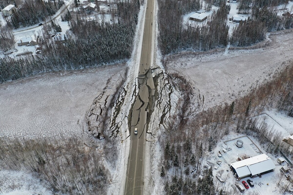
- 30 Nov 2018USGSM 7.1 – 1 km SE of Point MacKenzie, Alaska (event page)
- 12 Aug 2018USGSM 6.4 – 89 km SW of Kaktovik, Alaska (event page)
- 4 May 2018USGSM 6.9 – 18 km SSW of Leilani Estates, Hawaii (event page)
- 5 Apr 2018USGSM 5.3 – 31km SW of Santa Cruz Is. (E end), CA (event page)
- 23 Jan 2018USGSM 7.9 – 261 km SE of Chiniak, Alaska (event page)
2017
- 2 Sep 2017USGSM 5.3 – 12 km E of Soda Springs, Idaho (event page)
- 6 Jul 2017USGSM 5.8 – 11 km SE of Lincoln, Montana (event page)
- 24 May 2017USGSM 5.9 – 163 km ESE of Nikolski, Alaska (event page)
- 8 May 2017USGSM 6.2 – 135 km W of Adak, Alaska (event page)
- 1 May 2017USGSM 6.3 – 48 km NW of Mosquito Lake, Alaska (event page)
2016
- 28 Dec 2016USGSM 5.6 – 29 km SW of Hawthorne, Nevada (event page)
- 8 Dec 2016USGSM 6.6 – 164 km W of Ferndale, California (event page)
- 7 Nov 2016USGSM 5.0 – 3 km W of Cushing, Oklahoma (event page)
- 3 Sep 2016USGSM 5.8 – 14 km NW of Pawnee, Oklahoma (event page)
- 24 Jan 2016USGSM 7.1 – 47 km ESE of Pedro Bay, Alaska (event page)
2015
- 29 Jul 2015USGSM 6.4 – 52 km ENE of Pedro Bay, Alaska (event page)
- 27 Jul 2015USGSM 6.9 – Fox Islands, Aleutian Islands, Alaska (event page)
- 29 May 2015USGSM 6.8 – 117 km SSE of Ugashik, Alaska (event page)
- 22 May 2015USGSM 5.3 – 37 km SSW of Caliente, Nevada (event page)
- 28 Jan 2015USGSM 5.7 – 40 km SW of Ferndale, California (event page)
2014
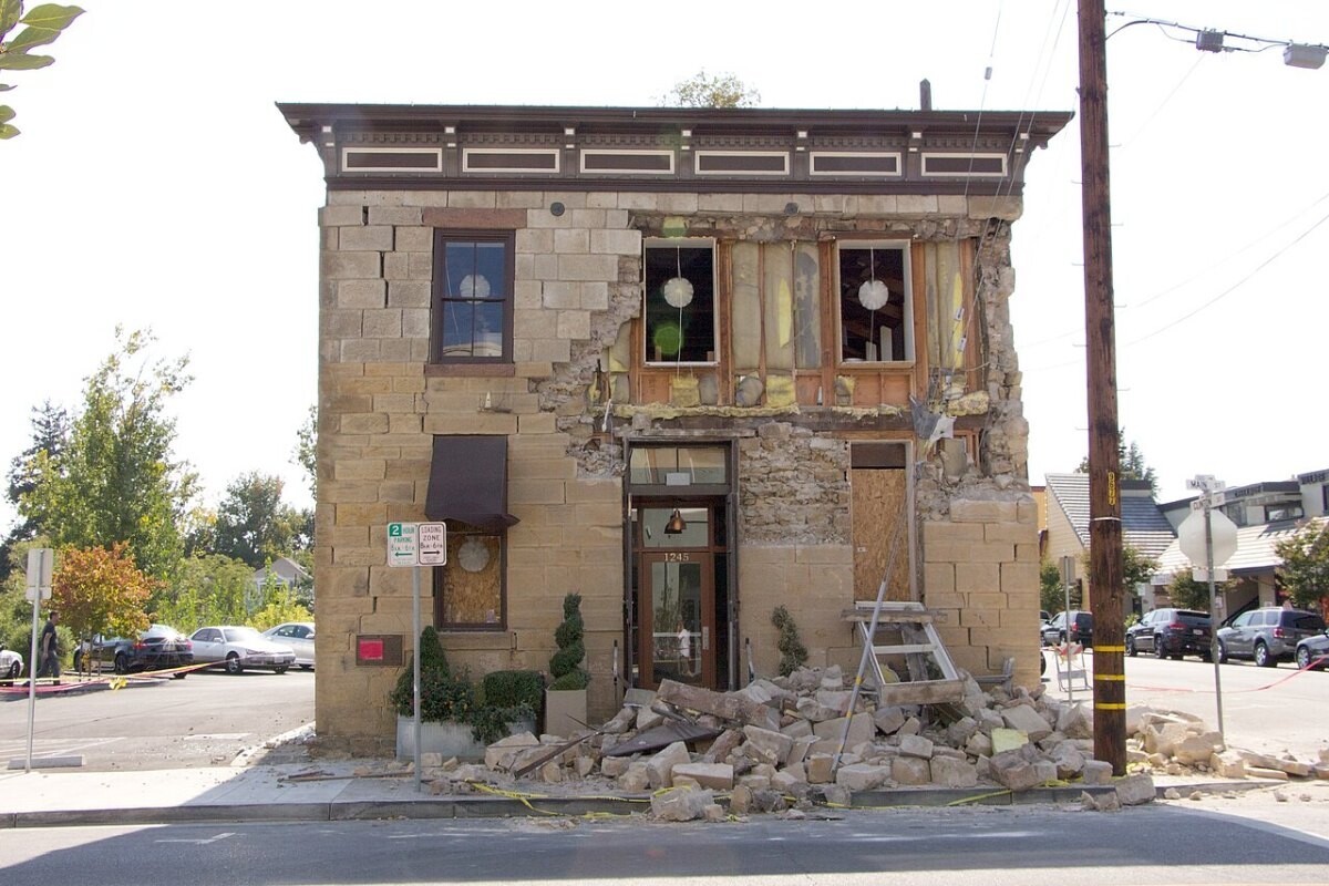
- 24 Aug 2014USGSM 6.0 – The 2014 South Napa, California Earthquake (event page)
- 29 Jun 2014USGSM 5.3 – 13 km SW of Franklin, Arizona (event page)
- 29 Mar 2014USGSM 5.1 – 2km NW of Brea, CA (event page)
- 10 Mar 2014USGSM 6.8 – 77 km WNW of Indianola, California (event page)
- 13 Jan 2014USGSM 6.4 – 61 km N of Hatillo, Puerto Rico (event page)
2013
- 4 Sep 2013USGSM 6.5 – 81 km SSW of Atka, Alaska (event page)
- 30 Aug 2013USGSM 7.0 – 101 km SW of Atka, Alaska (event page)
- 24 May 2013USGSM 5.7 – 2 km NNE of Canyondam, California (event page)
- 13 Feb 2013USGSM 5.1 – 39 km N of Dyer, Nevada (event page)
- 5 Jan 2013USGSM 7.5 – 110 km SW of Edna Bay, Alaska (event page)
2012
- 14 Dec 2012USGSM 6.3 – 279 km SSW of Avalon, California (event page)
- 4 Dec 2012USGSM 5.8 – 20 km ENE of Beluga, Alaska (event page)
- 12 Nov 2012USGSM 6.3 – 266 km SW of Yakutat, Alaska (event page)
- 26 Aug 2012USGSM 5.4 – 4km NNW of Brawley, CA (event page)
- 13 Feb 2012USGSM 5.6 – 26 km NNW of Willow Creek, California (event page)
2011
- 6 Nov 2011USGSM 5.7 – 8 km NW of Prague, Oklahoma (event page)
- 2 Sep 2011USGSM 6.9 – 170 km E of Atka, Alaska (event page)
- 23 Aug 2011USGSM 5.8 – 11 km SSW of Mineral, Virginia (event page)
- 23 Aug 2011USGSM 5.3 – 6 km S of Valdez, Colorado (event page)
- 24 Jun 2011USGSM 7.3 – Fox Islands, Aleutian Islands, Alaska (event page)
2010
- 7 Jul 2010USGSM 5.4 – 20km NNW of Borrego Springs, CA (event page)
- 15 Jun 2010USGSM 5.7 – 8km ESE of Ocotillo, CA (event page)
- 16 May 2010USGSM 5.8 – 4 km E of Moca, Puerto Rico (event page)
- 4 Apr 2010USGSM 7.2 – The 2010 Sierra El Mayor, B.C., Mexico Earthquake (event page)
- 10 Jan 2010USGSM 6.5 – The 2010 Eureka, California Earthquake (event page)
2009
- 13 Oct 2009USGSM 6.5 – 127 km E of Nikolski, Alaska (event page)
- 3 Oct 2009USGSM 5.2 – 18km NE of Olancha, CA (event page)
- 16 May 2009USGSM 5.9 – 136 km SE of Old Harbor, Alaska (event page)
- 30 Mar 2009USGSM 5.9 – 124 km SSE of Old Harbor, Alaska (event page)
- 24 Jan 2009USGSM 5.9 – Southern Alaska (event page)
2008
- 11 Oct 2008USGSM 6.1 – 91 km N of Charlotte Amalie, U.S. Virgin Islands (event page)
- 29 Jul 2008USGSM 5.4 – 5km S of Chino Hills, CA (event page)
- 2 May 2008USGSM 6.6 – 61 km W of Adak, Alaska (event page)
- 18 Apr 2008USGSM 5.2 – 7 km NNE of Bellmont, Illinois (event page)
- 21 Feb 2008USGSM 5.9 – 8 km ENE of Wells, Nevada (event page)
2007
- 19 Dec 2007USGSM 7.2 – 207 km WSW of Adak, Alaska (event page)
- 31 Oct 2007USGSM 5.4 – 6 km NNE of East Foothills, California (event page)
- 2 Oct 2007USGSM 6.3 – 72 km SSE of King Cove, Alaska (event page)
- 2 Aug 2007USGSM 6.7 – 239 km WSW of Adak, Alaska (event page)
- 26 Feb 2007USGSM 5.4 – 51 km W of Ferndale, California (event page)
Photo list
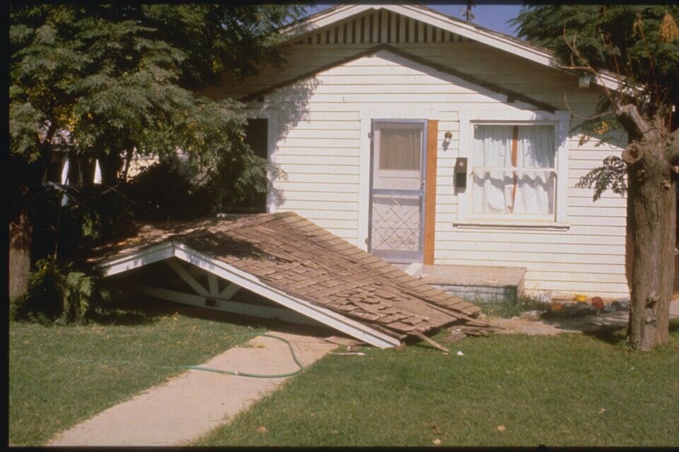
How this page is built. Figures come from the official statistical releases linked above; where agencies publish preliminary numbers we say so, because they are revised. Photos are public-domain or Creative Commons images credited in each caption; file photos are illustrative and are not from the events described unless the caption says so. This page tracks trends and is not personal safety, medical, legal or financial advice.