
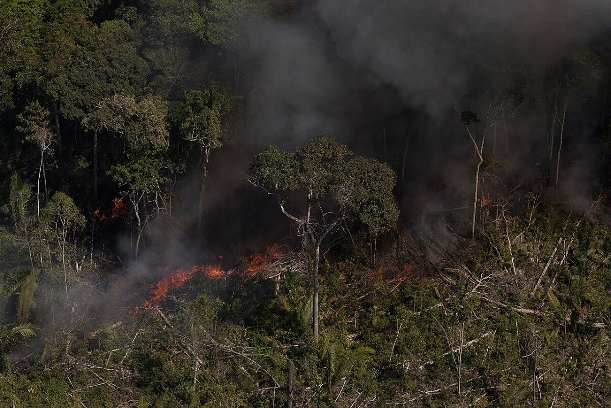
Trend summary
- INPE satellites logged 278,299 fire hotspots in Brazil in 2024, up 46.5% on 2023. The Amazon alone had 140,346 (Olhar Digital, INPE data).
- MapBiomas puts the 2024 burned area at about 30 million hectares, 62% above the 1985–2024 average. Native forest burned on a scale not seen in four decades (Agência Brasil).
- 2025 swung the other way: hotspots fell 51.8% and burned area was 12.7 million hectares, 31% below average. The Amazon burned less than in any of the past 41 years (Poder360; Agência Brasil).
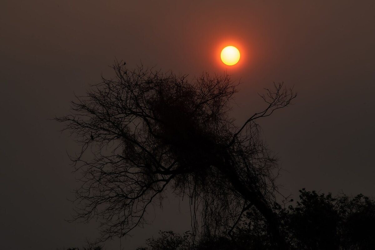
- Fire is back in 2026. In October Amazonas declared an emergency in 36 municipalities and smoke pushed fine-particle levels in Manaus to 196.4 µg/m³ (Agência Brasil).
What the numbers show
Brazil counts fire in two ways. INPE’s Queimadas programme counts satellite hotspots (focos de calor); MapBiomas Fogo maps the area actually burned. In 2024 INPE recorded 278,299 hotspots against 189,901 in 2023. The Amazon had 140,346 and the Cerrado 81,468 (Olhar Digital, citing INPE). For the Amazon this was the worst year since 2007, when 186,480 hotspots were logged (Agência Brasil). MapBiomas found about 30 million hectares burned. The Amazon lost 15.6 million hectares, a record and more than half the national total. The Cerrado lost 10.6 million and the Pantanal 2.2 million, 157% above its own average (Agência Brasil).
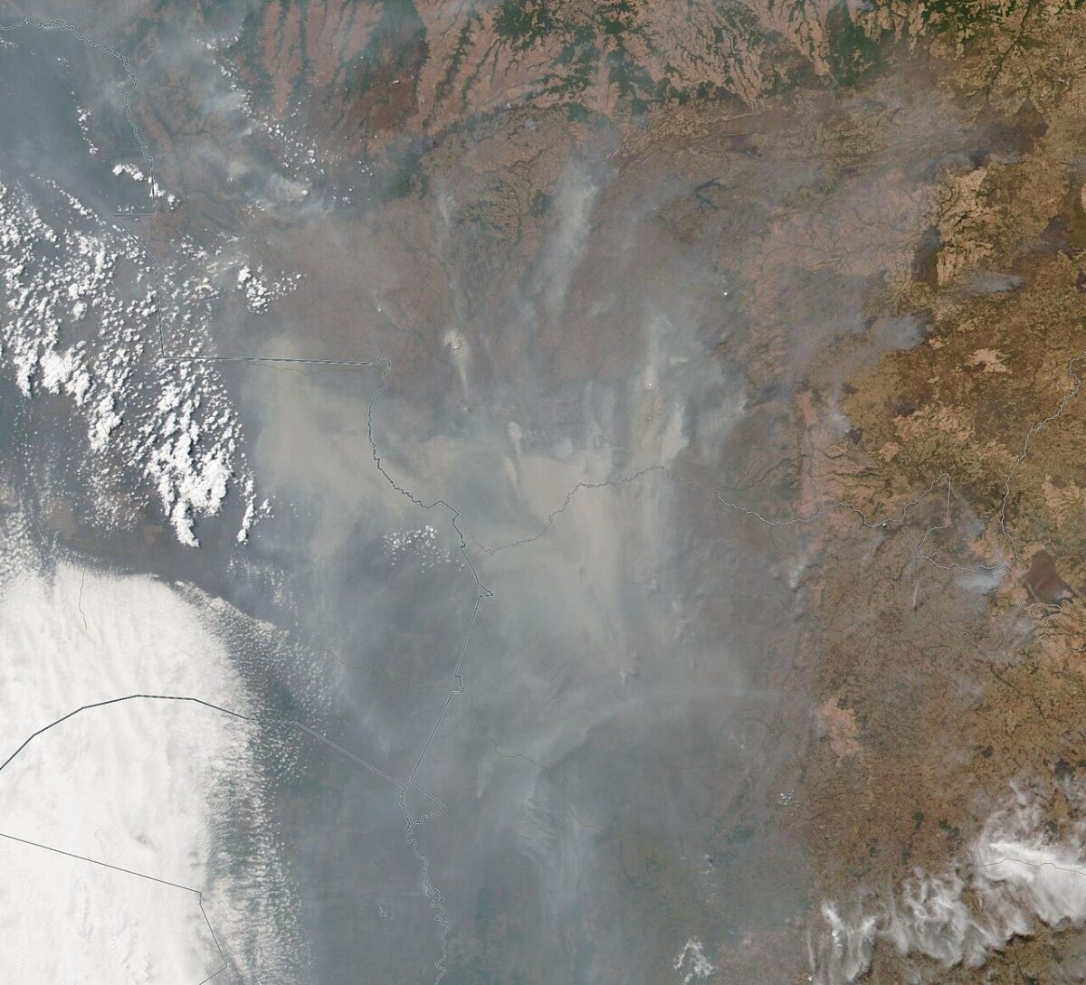
The Pantanal’s worst year remains 2020. An INPE study found that 44,998 km², more than 30% of the Brazilian Pantanal, burned that year (Agência Brasil). By 30 September 2020 the biome had 18,259 hotspots, well above the previous record of 12,536 set in 2005 (Agência Brasil). 2025 was a sharp break: 134,047 hotspots to 23 December, down 51.8% (Poder360), and 12.7 million hectares burned. The Amazon burned 3.1 million hectares and the Pantanal just 121,000, 85.6% below its average (Agência Brasil).
What is driving it
Almost all fire in Brazil is lit by people. A UFRJ team that tracks lightning and fire by satellite puts the human share at about 99% (Agência Brasil). A study by INPE, Cemaden and UFMA found Amazon fires were explained more by pasture burning and deforestation than by drought (Agência FAPESP). Drought then makes those fires spread. The Ministry of the Environment tied the 2024 surge to the worst drought in 74 years, and a strong El Niño is making 2026 harder (Agência Brasil).
The rules are changing. Law 14.944, signed on 31 July 2024, created the National Integrated Fire Management Policy. It sets when controlled burns are allowed, bans fire for clearing native vegetation and requires volunteer and private brigades to register with the fire service (Senate News Agency). Enforcement has also grown: IBAMA identified 242 people over the large 2024 fires, with fines and other measures above R$460 million (Agência Brasil). Smoke is the main public-health cost. In 2024 the health minister said fire was putting strong pressure on health units (Agência Brasil).
Recent cases
- 16 October 2026: Hotspots in Amazonas fell from a peak of 494 on 10 October to 188, after 330 firefighters coordinated by IBAMA and ICMBio put out more than 300 fires (Agência Brasil).
- 11 October 2026: Amazonas declared an emergency in 36 municipalities. The state logged 6,901 hotspots from 1 to 11 October, up 91.38% on the same period of 2025 (Agência Brasil).
- 21 July 2026: MapBiomas reported that 12.7 million hectares burned in 2025, 31% below the historical average and the Amazon’s smallest area in 41 years (Agência Brasil).
Press releases and official reports, 2023–2026
Five key releases a year for the last four years, newest first. Most come from federal ministries and agencies such as the Ministry of Health, INPE, the Federal Highway Police, CENIPA and the Central Bank, from Agência Brasil, the public news agency, and from the Senate and Chamber news services and state governments; a few news reports are included where they are the clearest public record of an event. Headlines are our English translations of the Portuguese originals. Releases from 2007–2022 are in the expandable list after 2023.
2026
- 16 Oct 2026Agência BrasilFire hotspots in Amazonas fall after task-force action
- 11 Oct 2026Agência BrasilGovernment helped as soon as Amazonas declared an emergency, says minister
- 21 Jul 2026Agência BrasilBurned area in Brazil 31% below the historical average in 2025
- 19 Jul 2026Agência BrasilDry weather heightens wildfire risk in inland São Paulo state
- 30 Jan 2026Agência BrasilJanuary's fire-hotspot count is twice the average
2025
- 26 Dec 2025Poder360Brazil's fire hotspots fall 51.8% in 2025
- 12 Sep 2025Agência Brasil2025 is the fifth-worst year for burned area up to August
- 24 Jun 2025Agência BrasilFires burned 30 million hectares in Brazil in 2024
- 2 Jun 2025Agência BrasilChamber of Deputies approves tougher penalties for starting forest fires
- 8 May 2025Agência BrasilIBAMA fines 242 people over criminal fires in 2024
2024
- 14 Dec 2024Agência BrasilAmazon has its highest number of fires in 17 years
- 14 Oct 2024Agência BrasilFire hotspots in Brazil already 76% higher than in 2023
- 15 Sep 2024Agência BrasilJustice Dino sets emergency budget for fighting fires
- 9 Sep 2024Agência BrasilHealth minister says fires are hitting the health system hard
- 1 Aug 2024Senate News AgencyNew law sets rules for the use of fire in rural areas
2023
- 18 Oct 2023Agência BrasilIBAMA sets environmental action guidelines for 2024
- 29 Aug 2023Agência BrasilFires burned 30% of the Pantanal in 2020, study shows
- 25 Jul 2023Agência BrasilBrazil had 2.15 million hectares burned in the first half of the year
- 26 Apr 2023Agência BrasilBrazil burned an area the size of Colombia and Chile between 1985 and 2022
- 15 Mar 2023Agência BrasilFire in the Yanomami Indigenous Territory falls 62% in two months
View 20 years of major Brazilian wildfire press releases (2007–2026)62 more from 2007–2022, up to five a year, newest first
2022
- 20 Dec 2022Agência BrasilForest fires increase in the Amazon after the new Forest Code
- 29 Nov 2022Agência FAPESPAmazon fire hotspots in August and September 2022 were the highest since 2010
- 27 Oct 2022Agência FAPESPAmazon fire is linked more to pasture burning and deforestation than to drought, study says
- 22 Jul 2022Agência BrasilPantanal fires prompt state of emergency in 14 Mato Grosso do Sul towns
- 23 Jun 2022Agência BrasilDecree suspends burning across the whole country
2021
- 1 Nov 2021Agência BrasilOperation fought 16,500 forest fires in three months
- 28 Oct 2021Agência BrasilChamber of Deputies approves rules for controlled use of fire in farming
- 24 Sep 2021Agência BrasilMinas Gerais: firefighters answer 1,129 fire calls in a week
- 3 Sep 2021Agência BrasilOperation Guardians of the Biome fights 5,500 fires in August
- 22 Jul 2021Agência BrasilGovernment launches plan to fight forest fires
2020
- 1 Oct 2020Agência BrasilFire has already destroyed 3.461 million hectares of the Pantanal
- 17 Aug 2020Agência BrasilFires in Mato Grosso do Sul up 74% on 2019
- 6 Aug 2020Agência BrasilCivil Defence recognises state of emergency in Mato Grosso do Sul municipalities
- 15 Jul 2020Agência BrasilDecree bans burning across Brazil for 120 days
- 22 Jan 2020Agência BrasilProsecutors ask for further investigation into Alter do Chão fires
2019
- 20 Dec 2019Agência BrasilVolunteer firefighters indicted over Alter do Chão fires
- 28 Nov 2019Agência BrasilFederal prosecutors see no evidence that brigade members started forest fires
- 29 Aug 2019Agência BrasilGovernment suspends burning nationwide for 60 days
- 22 Aug 2019Agência FAPESPResearchers trace the path of the 'river of smoke' that darkened São Paulo
- 10 Jun 2019Agência BrasilFederal brigades to prevent and fight forest fires
2018
- 28 Sep 2018Senate News AgencyBill raises penalties for releasing São João festival balloons
- 14 Sep 2018Agência BrasilMato Grosso may extend burning ban to October
- 3 Jul 2018INPEINPE improves its Amazon fire-monitoring system
- 27 Jun 2018Agência BrasilFires in forest and crop areas up 52% this year
- 21 Jan 2018Agência BrasilResearchers show Amazon fire smoke can cause cancer
2017
- 16 Sep 2017Agência BrasilDry September weather helps fires spread; human action is the main cause
- 11 Sep 2017Agência BrasilGovernment and civil society seek deal to curb Cerrado deforestation
- 13 Apr 2017Agência BrasilDeforestation, fires and gas emissions in the Cerrado to be monitored
- 22 Feb 2017Agência BrasilMinistry sets environmental-emergency calendar against fires
2016
- 14 Oct 2016Agência BrasilFires in Teresina leave at least four families homeless
- 8 Aug 2016Agência BrasilINPE warns of 65% rise in forest fires in 2016
- 13 Apr 2016Agência FAPESPStudy tests how Cerrado vegetation withstands fire
- 28 Mar 2016Agência FAPESPSystem makes joint weather and air-quality forecasts for South America
- 5 Jan 2016Agência BrasilFires rise 27.5% in Brazil in 2015, INPE shows
2015
- 8 Dec 2015Senate News AgencyWalter Pinheiro draws attention to the fire in Chapada Diamantina
- 4 Aug 2015Agência BrasilStronger El Niño raises fire risk in the eastern Amazon
- 4 Mar 2015Agência BrasilGovernment sets calendar for environmental-emergency declarations
2014
- 17 Oct 2014Agência BrasilFires in October double compared with the same month of 2013
- 10 Feb 2014Agência BrasilOfficial Gazette publishes calendar for environmental-emergency declarations
- 5 Feb 2014Agência BrasilRio sets record for fire hotspots in 2014 due to heat wave
2012
- 25 May 2012Presidency (Planalto)Law 12,651: the new Forest Code, including prevention and control of forest fires
- 28 Mar 2012Senate News AgencyLídice da Mata calls for more resources to fight fires in Chapada Diamantina
2011
- 25 Oct 2011Senate News AgencyControlled burning in the Cerrado can prevent large wildfires, scientists say
- 21 Oct 2011Senate News AgencyScientists debate the environmental impact of forest fires
- 13 Oct 2011Agência FAPESPThe impact of fires on the greenhouse effect
2010
- 1 Oct 2010Senate News AgencyTV Senado shows the fire in Brasília National Park
- 24 Aug 2010Senate News AgencyFires hit 11 states and worry senators
- 18 Aug 2010Senate News AgencyAcir Gurgacz warns of forest fires in Rondônia
- 17 Feb 2010Senate News AgencyAugusto Botelho urges Roraima residents to avoid burning
- 4 Feb 2010Senate News AgencyAugusto Botelho warns fires could cause a new disaster in Roraima
2009
- 16 Sep 2009Senate News AgencyMesquita Júnior: Acre government should help farmers avoid burning
- 24 Aug 2009Senate News AgencyMesquita Júnior announces prosecutors' lawsuit to end burning in Acre
- 10 Jul 2009Senate News AgencyMesquita Júnior condemns Acre government's criticism of court ruling on burning
- 17 Apr 2009Senate News AgencyBurning may be banned outright in Acre from 2011, Mesquita Júnior announces
2008
- 12 Dec 2008Senate News AgencyTemporary Environmental Risk Committee presents its report on Tuesday
- 22 Jul 2008Presidency (Planalto)Decree 6,514 on environmental infractions and penalties (Art. 58: fines for unauthorised use of fire)
- 19 Feb 2008Senate News AgencyTuma wants an external committee to verify data on fires in the Amazon
2007
- 19 Sep 2007Senate News AgencyRaupp calls for more investment in fighting forest fires
- 17 Sep 2007Senate News AgencyCasagrande: 75% of Brazil's greenhouse gas emissions come from burning vegetation
- 6 Sep 2007Senate News AgencyJayme Campos proposes a national brigade against fires
- 10 Aug 2007Agência FAPESPKeeping an eye on fire
- 22 Mar 2007Senate News AgencyMarconi Perillo calls for action against fires
Many years list fewer than five items, and some have none yet. Older federal releases and the 2007–2013 Agência Brasil archive are hard to reach at their original addresses, and we only list items we could open and check. We are still adding to these lists. Where a page shows no date, the date comes from the release address or the publisher’s own index.
Photo list
How this page is built. Figures come from the official statistical releases linked above; where agencies publish provisional numbers we say so, because they are revised. Brazil’s national death data come from the Ministry of Health mortality system (SIM/DATASUS) and are usually final about two years later, and some topics, such as fires, have no single national count, so we say which year and source each figure covers. Money is given in reais (R$). Headlines and quotes are our translations from Portuguese. Photos are public-domain or Creative Commons images credited in each caption; file photos are illustrative and are not from the events described unless the caption says so. This page tracks trends and is not personal safety, medical, legal or financial advice.