
Trend summary
- Mainland France has moderate seismicity: about one highly destructive earthquake and four seriously damaging ones per century, according to BRGM. The deadliest of the 20th century, at Lambesc in Provence in 1909, killed about fifty people.
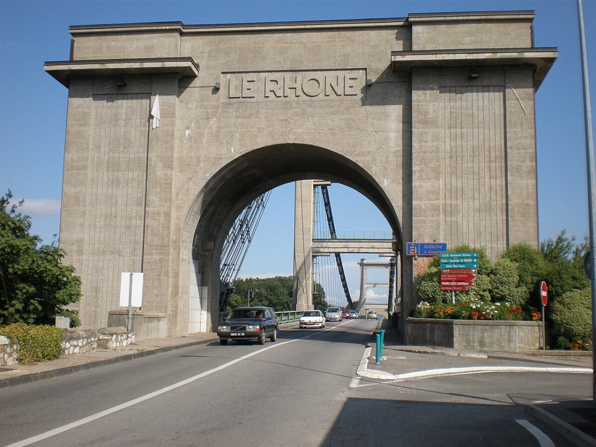
- The Le Teil earthquake of 11 November 2019 (Mw 4.9) was small but unusually shallow, at about 1–3 km. It cracked hundreds of buildings in the Rhône valley, injured four people and led to more than 1,000 people being rehoused.
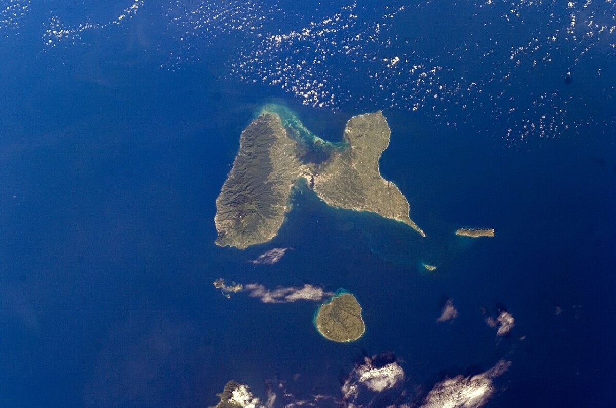
- The French Antilles (Guadeloupe and Martinique) face the highest hazard, rated zone 5. The 1843 Guadeloupe earthquake killed more than 1,500 people. Since 2007 the Plan Séisme Antilles has spent about €1.08 billion (2007–2019) on schools, fire stations, hospitals and social housing.
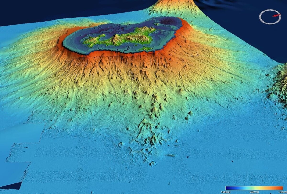
- Off Mayotte, a seismic swarm that began on 10 May 2018 produced 2,047 located earthquakes of magnitude 3.5 or more by January 2021 and built a new submarine volcano, the largest active submarine eruption ever documented.
What the numbers show
France does not publish a single yearly earthquake count; its seismic monitoring is shared between BCSF-RéNaSS (Strasbourg), CEA and the volcano observatories of IPGP. History sets the scale. BRGM’s SisFrance database, which covers about a thousand years, shows roughly one highly destructive and four seriously damaging earthquakes per century in mainland France (BRGM). The Provence earthquake of 11 June 1909 at Lambesc killed about fifty people; in the Antilles, the 8 February 1843 earthquake killed more than 1,500 people and the 11 January 1839 Martinique earthquake several hundred; the Les Saintes earthquake of 21 November 2004 (M6.3) killed one person (Géorisques). Since 1 May 2011 a five-zone map, set by decrees of 22 October 2010, applies seismic building rules in zones 2 to 5, which cover about 21,000 communes, up from just over 5,000 under the old map (Maire-info/AMF; Géorisques). All of Guadeloupe and Martinique sit in zone 5.
The Le Teil earthquake of 11 November 2019 (Mw 4.9; local magnitude 5.4 by CEA) reached intensity VIII in parts of Le Teil (Comptes Rendus Géoscience). IRSN reported four injured, about 50 cracked buildings in Le Teil and Saint-Thomé in the first days, and checks at the Cruas nuclear plant about 12 km away, with no damage found (IRSN). By 22 November more than 1,000 people had been rehoused and more than 1,750 building checks carried out (Banque des Territoires). In June 2023 the La Laigne earthquake (Charente-Maritime, Mw 4.8–4.9) damaged 135 homes in a village of about 500 people and 170 people had to be rehoused (CEA). Off Mayotte, REVOSIMA counted 2,047 located earthquakes of magnitude 3.5 or more between 10 May 2018 and 31 January 2021, the largest Mw 5.9 on 15 May 2018; the island sank by about 10–19 cm and moved 21–25 cm east (REVOSIMA bulletin 26).
What is driving it
Most French earthquakes are small, but shallow ones do outsized damage. Field, seismic and satellite (InSAR) data show the Le Teil rupture reactivated the old La Rouvière fault, broke the surface along about 5 km and lifted the ground by up to 15 cm; the fault showed no clear sign of having moved for thousands of years (Ritz et al., 2020, Communications Earth & Environment). Modelling suggests ground acceleration near the fault locally exceeded gravity, far above what is usual for a quake of that size (Causse et al., 2021). Old masonry was the weak point at Le Teil: the few buildings that collapsed there and in Viviers were among the oldest, 19th-century ones (Cornou et al., 2021). In Mayotte the cause is volcanic: deep magma reservoirs (below 55 km) drained through dykes and built an 820 m-tall, ~5 km³ volcano on the sea floor by May 2019 (Feuillet et al., 2021, Nature Geoscience).
Policy has focused on buildings rather than prediction. The 2011 zoning brought about 21,000 communes under construction rules (Maire-info/AMF). In the Antilles, the Plan Séisme Antilles began in 2007; its first phase (2007–2013) invested or programmed more than €2.4 billion including housing and hospitals, but only 30 of 100 planned primary schools were completed (Plan Séisme Antilles, 2016). The third phase (2021–2027) aims to protect, for example, 66.4% of primary pupils in Martinique and 54.1% in Guadeloupe by 2027, and puts the cost of retrofitting private buildings at €5–6 billion (PSA3 framework, 2021). The Senate warned in 2018 that overseas territories face an “emergency” on natural risks (Senate), and Mayotte’s monitoring network, REVOSIMA, received €3.7 million of state funding in 2023 (Mayotte Hebdo).
Recent cases
- 16 May 2026: A magnitude 6.3 earthquake struck north-north-east of Anse-Bertrand, Guadeloupe, at a depth of 57 km. BCSF-RéNaSS collected 131 felt reports, with a highest preliminary intensity of 5 at Baie-Mahault; no damage was listed (BCSF-RéNaSS).
- 2 January 2026: A magnitude 5.7 earthquake, 32 km deep and about 59 km north-east of Trinité, shook Martinique. The OVSM observatory estimated intensity V near the coast and locally VI–VII depending on soil (IPGP-OVSM).
- 27 October 2025: A magnitude 6.6 earthquake about 168 km east of La Désirade was widely felt across Guadeloupe at intensity IV–V, locally up to VI, according to the OVSG observatory (IPGP-OVSG).
Press releases and official reports, 2023–2026
Five key releases a year for the last four years, newest first. Most come from national bodies such as ONISR, the Ministry of the Interior, Santé publique France, the BEA and BEAmer investigation bureaus and the Banque de France, from the Senate and National Assembly, and from research journals; a few news reports are included where they are the clearest public record of an event. Headlines are our English translations of the French originals. Releases from 2007–2022 are in the expandable list after 2023.
2026
- 20 Sep 2026BCSF-RéNaSSEarthquake east-north-east of Trinité, Martinique (M4.7, depth 53 km)
- 16 May 2026BCSF-RéNaSSEarthquake north-north-east of Anse-Bertrand, Guadeloupe (M6.3): felt reports and intensity map
- 16 Apr 2026BCSF-RéNaSSEarthquake east-north-east of Trinité, Martinique (M4.1): felt reports and intensity map
- 2 Jan 2026IPGP-OVSMEarthquake report for Martinique (M5.7, 2 January 2026)
- 2 Jan 2026BCSF-RéNaSSEarthquake north-east of Trinité, Martinique (M5.7): 228 felt reports and intensity map
2025
- 27 Oct 2025IPGP-OVSGPreliminary earthquake report for Guadeloupe and the Northern Islands (M6.6)
- 27 Oct 2025BCSF-RéNaSSEarthquake 168 km east of La Désirade, Guadeloupe (M6.6): felt reports
- 22 Oct 2025SeismicaThe extremely shallow MW 4.9 2019 Le Teil earthquake, France: main ground motion features and comparison with ground motion models
- 6 May 2025BCSF-RéNaSSEarthquake at Le Cheylas (Isère, M4.1): post-earthquake report
- 18 Mar 2025BCSF-RéNaSSEarthquake 13 km from Berre-les-Alpes (Alpes-Maritimes, M3.7): post-earthquake report
2024
- 12 Dec 2024BCSF-RéNaSSWeb-service (API) access to preliminary municipal intensity data from felt reports
- 24 Sep 2024BCSF-RéNaSSEarthquake at Ligueil (Indre-et-Loire, ML 3.4): post-earthquake report
- 21 May 2024BCSF-RéNaSSEarthquake south of Bagnères-de-Bigorre (Hautes-Pyrénées, M4.0): post-earthquake report
- 27 Feb 2024BCSF-RéNaSSEarthquake at Porrentruy (Switzerland, MLv 3.5), felt in Doubs: post-earthquake report
- 11 Feb 2024BCSF-RéNaSSEarthquake north-east of Vesoul (Haute-Saône, MLv 3.6): post-earthquake report
2023
- 26 Jun 2023BRGMEarthquake in the village of La Laigne in Charente-Maritime: initial analyses
- 16 Jun 2023CEAMagnitude ML 5.8 earthquake on 16/06/2023 south-west of Niort (Deux-Sèvres)
- 16 Jun 2023BCSF-RéNaSSLa Laigne earthquake (Charente-Maritime, ML 5.3): post-earthquake report
- Apr 2023vie-publique.frEvaluation of natural and technological risk prevention policy in Martinique (CGAAER/IGEDD report)
- 13 Feb 2023Mayotte HebdoThe State steps up monitoring of seismic and volcanic activity
View 20 years of major French earthquake press releases (2007–2026)65 more from 2007–2022, up to five a year, newest first
2022
- 23 Oct 2022BCSF-RéNaSSNostang earthquake (Morbihan, M3.9): post-earthquake report
- 10 Sep 2022BCSF-RéNaSSSierentz earthquake (Haut-Rhin, M4.8): post-earthquake report
- 30 Jun 2022BCSF-RéNaSSMacroseismic report: earthquake north-east of Angoulême, 30 June 2022 (M4.1)
- 12 Mar 2022BCSF-RéNaSSMacroseismic report: Albertville earthquakes of 12 March 2022 (ML 4.2)
- 10 Jan 2022BRGMThe SisFrance website on historical earthquakes in mainland France has been revamped
2021
- 26 Aug 2021Nature GeoscienceBirth of a large volcanic edifice offshore Mayotte via lithosphere-scale dyke intrusion
- 26 Jun 2021BCSF-RéNaSSEarthquake 6 km north of Strasbourg (La Wantzenau, ML 3.9): post-earthquake report
- 3 Jun 2021DIRMOM / DEAL GuadeloupePlan Séisme Antilles: objectives of the third phase, 2021–2027
- 6 May 2021Banque des TerritoiresPlan Séisme Antilles, season 3
- 20 Jan 2021Communications Earth & EnvironmentExceptional ground motion during the shallow Mw 4.9 2019 Le Teil earthquake, France
2020
- 5 Sep 2020OSF PreprintsRapid response to the Mw 4.9 earthquake of November 11, 2019 in Le Teil, Lower Rhône Valley, France
- 27 Aug 2020Communications Earth & EnvironmentSurface rupture and shallow fault reactivation during the 2019 Mw 4.9 Le Teil earthquake, France
- 25 Aug 2020BRGMTwo years of seismic crisis and the birth of an underwater volcano in Mayotte
- 19 Feb 2020BCSF-RéNaSSMacroseismic report: Brest earthquake of 19 February 2020
2019
- 26 Nov 2019Banque des TerritoiresRhône valley earthquake: nine communes in Ardèche and Drôme recognised as natural disasters
- 14 Nov 2019SenateOn major natural risks in the overseas territories (reconstruction and resilience), information report no. 122
- 14 Nov 2019IRSNLe Teil (Ardèche) earthquake: information note
- 11 Nov 2019BCSF-RéNaSSMacroseismic report on the Le Teil earthquake, 11 November 2019
- 11 Oct 2019Maire-infoPlan Séisme Antilles: four priorities and €133 million for 2019–2022
2018
- 17 Dec 2018BRGMEarthquake swarm in Mayotte: a clearer understanding is emerging
- 24 Jul 2018SenateMajor natural risks: emergency declared overseas, information report no. 688
- 13 Jul 2018BCSF-RéNaSSSeismic swarm east of Mayotte: analysis for 10 May–15 June 2018
- 15 May 2018BCSF-RéNaSSEarthquake 33 km east of Pamandzi, Mayotte (M5.7, depth 17 km): macroseismic note
- 12 Feb 2018BCSF-RéNaSSEarthquake 23 km north-north-east of Fontenay-le-Comte (Vendée, M4.7): post-earthquake report
2017
- 28 Oct 2017BCSF-RéNaSSEarthquake west of Saint-Lary-Soulan (Hautes-Pyrénées, ML 4.1): post-earthquake report
- 28 Sep 2017BCSF-RéNaSSEarthquake 4 km west of Janzé (Ille-et-Vilaine, ML 3.9): post-earthquake report
- 3 Feb 2017BCSF-RéNaSSEarthquake 127 km south-east of Capesterre-de-Marie-Galante (M5.8, depth 32 km): post-earthquake report
- 2017DREAL OccitanieSeismic risk in the Pyrenees (2017 edition)
2016
- 3 Sep 2016BCSF-RéNaSSEarthquake 34 km north of Nice (Alpes-Maritimes, ML 3.7): post-earthquake report
- Jul 2016Ministry of Environment / Ministry of OverseasPlan Séisme Antilles – Horizon 2020: objectives of the second phase (2016–2020)
- 11 May 2016BCSF-RéNaSSEarthquake north-west of Oloron-Sainte-Marie (Pyrénées-Atlantiques, M3.9): post-earthquake report
- 28 Apr 2016CEAInformation on the Oléron earthquake of 28/04/2016 at 06:46 UT
- 25 Apr 2016BCSF-RéNaSSEarthquake 31 km north-west of Pau (Pyrénées-Atlantiques, ML 4.0): post-earthquake report
2015
- 22 May 2015BCSF-RéNaSSEarthquake at Ramsgate, England (ML 4.0), felt in northern France: macroseismic report
- 29 Jan 2015BCSF-RéNaSSEarthquake north-west of Bressuire (Deux-Sèvres, ML 3.5): post-earthquake report
2014
- 18 Nov 2014Prefecture of GuadeloupeTen years after the Les Saintes earthquake, monitoring is still needed
- 11 Jul 2014BCSF-RéNaSSEarthquake 30 km south-west of St Helier, Jersey (ML 4.8): post-earthquake report
- 29 Apr 2014BCSF-RéNaSSEarthquake south-east of Lourdes (Hautes-Pyrénées, ML 4.7): post-earthquake report
- 7 Apr 2014CEAMagnitude-5.3 seismic event on 7 April 2014 to the North East of Barcelonnette
- 7 Apr 2014BCSF-RéNaSSEarthquake north-west of Barcelonnette (Alpes-de-Haute-Provence, ML 5.2): seismological report
2013
- 21 Nov 2013BCSF-RéNaSSEarthquake 2 km east of Vannes (Morbihan, ML 4.6): seismological and macroseismic report
- 15 Oct 2013National AssemblyGuadeloupe and Martinique: further earthquake-prevention measures in high-hazard zones, including earthquake-resistant school desks (written question no. 40153)
- 15 Oct 2013CATNATNational action framework for seismic risk prevention finalised
- 25 Sep 2013BCSF-RéNaSSEarthquake west-south-west of Châtillon-sur-Loire (Loiret, ML 3.57): macroseismic report
2012
- 27 Feb 2012CATNATMagnitude 4.9 earthquake and aftershocks in Alpes-de-Haute-Provence
- 26 Feb 2012BCSF-RéNaSSEarthquake north-east of Barcelonnette (Alpes-de-Haute-Provence, ML 4.9): post-earthquake report
- 22 Feb 2012SenateOral question No. 1599S on the new earthquake-resistant building regulations, with the government's answer
2011
- 3 Aug 2011BCSF-RéNaSSEarthquake south of Largentière (Ardèche, M4.5): post-earthquake report
- 7 Jul 2011BCSF-RéNaSSEarthquake 100 km west of Ajaccio (Corse-du-Sud, M5.5): post-earthquake report
- 30 Jun 2011OPECST (Parliament)Nuclear safety: interim report, including seismic risk to French plants
- 27 Apr 2011Maire-infoFrance's new seismic zoning takes effect on 1 May 2011
- 2 Feb 2011SenateFrance's level of preparedness for an earthquake (oral question and government answer)
2010
- 28 Oct 2010SenateIs France prepared for an earthquake?
- 22 Oct 2010LégifranceDecree no. 2010-1255 of 22 October 2010 delimiting the seismic zones of French territory
- 22 Oct 2010LégifranceDecree no. 2010-1254 of 22 October 2010 on seismic risk prevention
- 22 Oct 2010LégifranceOrder of 22 October 2010 on the classification and earthquake-resistant building rules for 'normal risk' buildings
- 8 Jul 2010OPECST (Parliament)Is France prepared for an earthquake? Record of the public hearing of 7 July 2010, report no. 653
2009
- 4 Aug 2009National AssemblyEarthquakes: state of seismology and earthquake-prediction research after L'Aquila (written question no. 50497 and ministerial answer)
2008
- 18 May 2008BCSF-RéNaSSEarthquake north-north-west of Argelès-Gazost (Hautes-Pyrénées, ML 4.2): seismological and macroseismic report
- 23 Feb 2008BCSF-RéNaSSEarthquake north-north-east of Saarlouis, Germany (ML 4.3): macroseismic note
- 3 Jan 2008BCSF-RéNaSSEarthquake north-east of Saarlouis, Germany (ML 3.6): macroseismic note
2007
- 12 Dec 2007IRSNMartinique (Antilles, France) earthquake of Thursday 29 November 2007
- 7 Dec 2007OPECST (Parliament)Assessing and preventing tsunami risk on French coasts, mainland and overseas, report no. 117
- 29 Nov 2007BCSF-RéNaSSEarthquake 25 km north of Martinique: seismological synthesis and macroseismic study
- 15 Nov 2007BCSF-RéNaSSArgelès-Gazost earthquake (Hautes-Pyrénées): macroseismic report
Many years list fewer than five items, and some have none yet. Several official archives (Légifrance, older ministry pages and PDFs) could not be opened when we compiled this list, and we only list items we could open and check. We are still adding to these lists. Where a page shows no date, the date comes from the publisher’s own index; annual reports with no printed date are listed under the year they cover or were released.
Photo list
How this page is built. Figures come from the official statistical releases and research linked above; where agencies publish provisional numbers we say so, because they are revised. National death data come from Inserm’s cause-of-death centre (CépiDc) and take two to three years to finalise, and some figures cover metropolitan France only while others include the overseas departments, so we say which year, area and source each figure covers. Money is given in euros. Headlines and quotes are our translations from French. Photos are public-domain or Creative Commons images credited in each caption; file photos are illustrative and are not from the events described unless the caption says so. This page tracks trends and is not personal safety, medical, legal or financial advice.