
Trend summary
- Satellites picked up 203,544 forest fire hotspots in India in the 2023-24 season, down from 223,333 in 2021-22.
- The worst recent season was November 2020 to June 2021, with 345,989 detections. Odisha and Madhya Pradesh topped that list.
- The Forest Survey of India mapped 34,562 km² of fire-affected forest in 2023-24. Andhra Pradesh, Maharashtra and Telangana were hit hardest.
- Most fires are lit by people, and the season peaks in March and April. In 2025 the Centre approved a ₹818.92 crore fire-risk scheme for 144 districts.
What the numbers show
The Forest Survey of India (FSI) counts fires from space, using the SNPP-VIIRS sensor. Its season runs from November to June. Detections were 210,286 in 2018-19, fell to 124,473 in 2019-20, and jumped to 345,989 in 2020-21. They then eased to 223,333 in 2021-22 and 212,249 in 2022-23 (PIB, Aug 2023). The 2023-24 season came in at 203,544 hotspots (PIB, Dec 2024). A detection is a hot pixel, not a separate fire, so one large blaze can show up many times.
The fires are not spread evenly. In 2022-23 Odisha led with 33,461 detections, followed by Chhattisgarh (20,306) and Andhra Pradesh (19,367) (PIB). FSI’s burnt-area study for 2023-24 found 34,562.33 km² of fire-affected forest, with Andhra Pradesh (5,286.76 km²), Maharashtra (4,095.04 km²) and Telangana (3,983.28 km²) at the top (FSI). An earlier FSI sample estimate put the 2019-20 burnt area at 11,094 km², or 1.56% of forest cover (FSI, 2020); the two studies used different methods, so they are not a like-for-like trend. FSI’s latest risk map puts 3.13% of recorded forest in the very-high-risk zone, with Mizoram holding the largest such area (FSI).
What is driving it
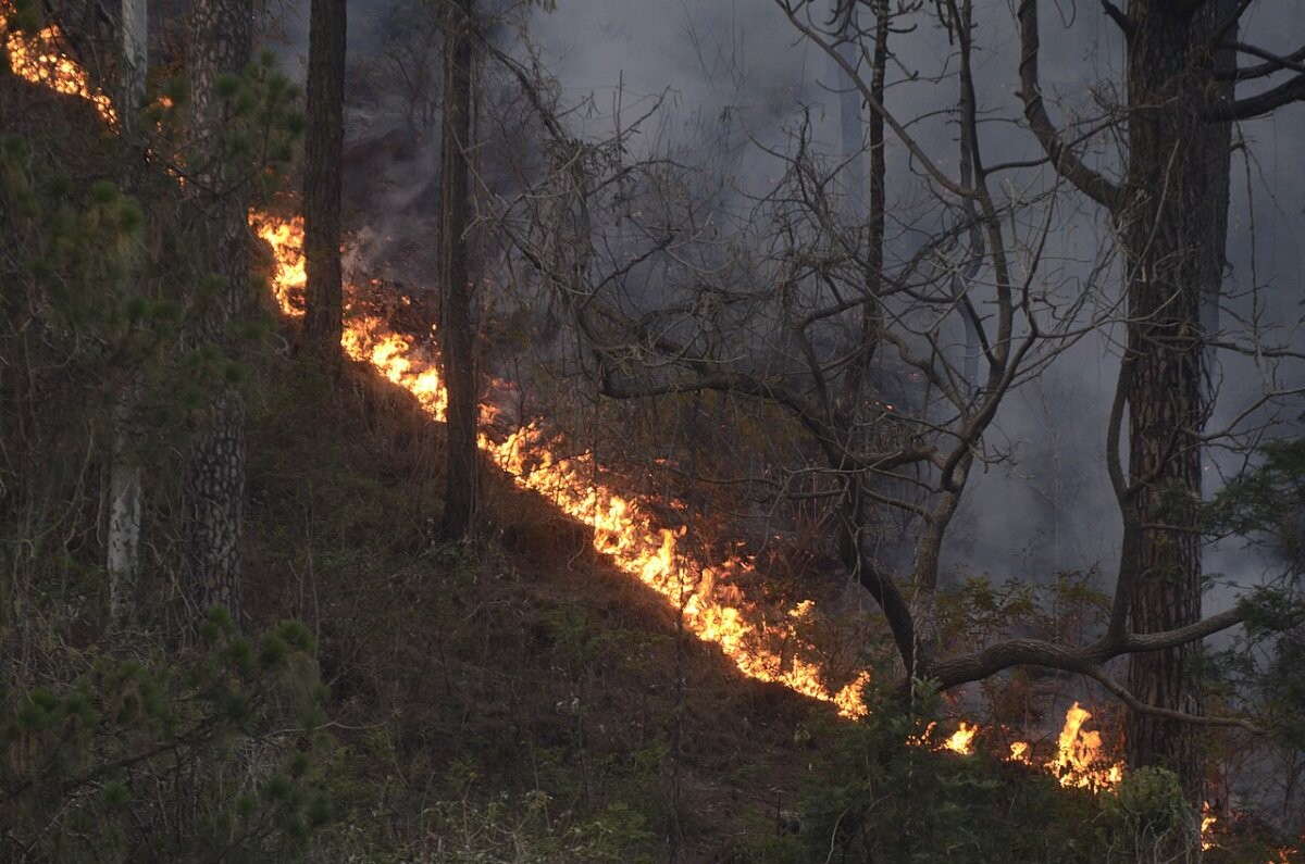
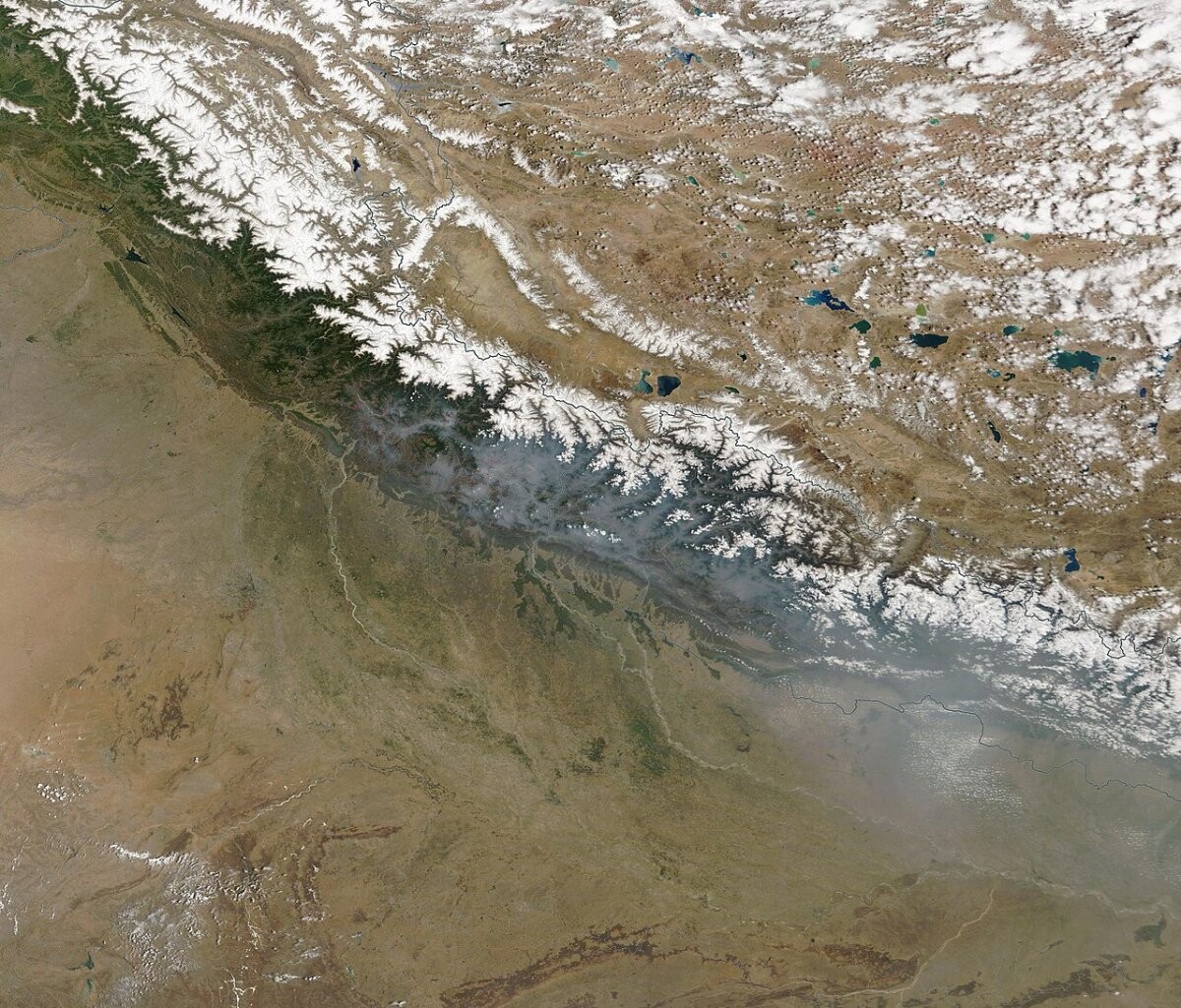
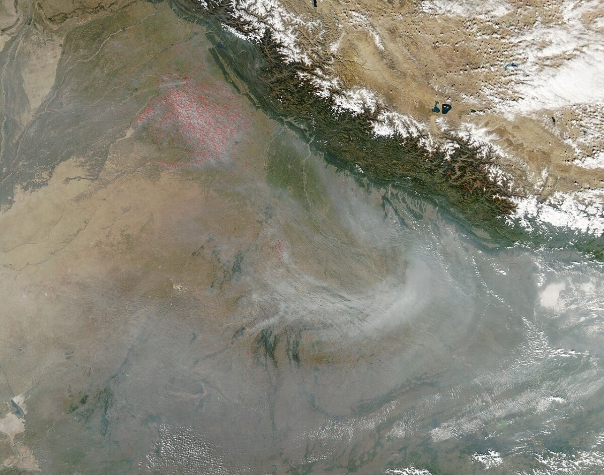
People start most of these fires. The environment ministry has long said so: land clearing, shifting cultivation, grazing and gathering forest produce are the usual causes (PIB, 2007). Dry deciduous forests burn most often, while evergreen and temperate forests burn less (ISFR 2021). In the hills, resin-rich chir pine needles pile up as fuel; NASA linked them, along with drought and heat, to a 55% rise in fire numbers in 2016 (NASA). In 2024 Uttarakhand told the Supreme Court that all 398 forest fires since November 2023 were man-made (Scroll).
The response has shifted from counting fires to stopping them faster. FSI now sends near real-time alerts to forest staff, and the ministry says the share of large fires doused within 24 hours rose from 33% to 67% (PIB, Dec 2024). In January 2025 a high-level committee approved a ₹818.92 crore Mitigation Scheme for Forest Fire Risk Management covering 144 high-priority districts in 19 states (PIB). Weather still sets the ceiling: a dry, hot spring in 2025 pushed March detections to 84,642, by FSI’s count as reported in the press (Kashmir Times).
Recent cases
- 30 May 2026: Indian Air Force helicopters fought a forest fire of nearly 10 hectares near Kasauli in Himachal Pradesh, dropping more than 93,000 litres of water, including at night (PIB).
- 17 February 2026: IAF helicopters put out a major wildfire at Walong in Arunachal Pradesh with 139,800 litres of water and flew water-bucket missions over Nagaland’s Dzukou Valley (PIB).
- 8 April 2025: FSI’s alert system showed more than 169 large forest fires burning at once, with Madhya Pradesh logging 3,204 fire incidents in a single week (Kashmir Times).
Press releases and official reports, 2023–2026
Up to five key releases a year for the last four years, newest first. Most come from Government of India ministries through the Press Information Bureau (PIB), national agencies such as NCRB, the Reserve Bank of India and the National Center for Seismology, and state governments; a few news reports and data analyses are included where they are the clearest public record of an event. Releases from 2007–2022 are in the expandable list after 2023.
2026
- 30 May 2026Ministry of DefenceIndian Air Force Conducts Round-the-Clock Aerial Firefighting Operations in Kasauli
- 7 Apr 2026Press Information BureauIndia's Green Pathway: From Conservation to Climate Action
- 17 Feb 2026Ministry of DefenceIndian Air Force Aerial Firefighting Operations in Arunachal Pradesh and Nagaland
- 2026Forest Survey of IndiaAssessment of Forest Fire Burnt Area Report 2023-24 (Technical Information Series Vol. 3, No. 1)
- 2026Forest Survey of IndiaForest Fire Risk Zonation of India 2023-24 (Technical Information Series Vol. 3, No. 3)
2025
- 31 Dec 2025Ministry of Environment, Forest and Climate ChangeYear-end Review 2025: A year dedicated to Forest Conservation, Wildlife Protection and Global Leadership in addressing Climate Change
- 9 May 2025Ministry of Environment, Forest and Climate ChangeIndia highlights Forest Conservation and Sustainable Forest Management achievements at the 20th Session of the United Nations Forum on Forests
- 8 Apr 2025Kashmir TimesHeatwave: Forest Fires Rage in Central India; Himalayan states affected too
- 20 Mar 2025Ministry of Environment, Forest and Climate ChangeInternational Day of Forests 2025
- 29 Jan 2025Ministry of Home AffairsA High-Level Committee (HLC), under the chairmanship of Union Home Minister and Minister of Cooperation, Shri Amit Shah approves Rs. 3027.86 crore for disaster mitigation for various states
2024
- 27 Dec 2024Ministry of Environment, Forest and Climate ChangeIndia's Green Recovery: Forest and Tree Cover Grows, Fire Incidents Fall
- 27 Dec 2024Ministry of Environment, Forest and Climate ChangeYear-end Review 2024: Ministry of Environment, Forest and Climate Change
- 21 Dec 2024Ministry of Environment, Forest and Climate ChangeUnion Minister Bhupender Yadav Releases India State of Forest Report 2023
- 20 Jun 2024Ministry of Environment, Forest and Climate ChangeShri Bhupender Yadav visits forest fire affected areas in Uttarakhand, says government remains committed to finding solutions to various reasons causing the fires leading to loss of valuable forests
- 13 Jun 2024PTI (via The Week)Uttarakhand Four forest workers killed while extinguishing fire in Binsar Wildlife Sanctuary
2023
- 7 Dec 2023Ministry of Environment, Forest and Climate ChangeMeasures taken to conserve forests
- 7 Aug 2023Ministry of Environment, Forest and Climate ChangeDamage due to Forest Fire
- 16 Mar 2023Ministry of Environment, Forest and Climate ChangeNational Action Plan on Forest Fire empowers all stakeholders to reduce vulnerability of forests against fire hazards
View 20 years of major Indian wildfire press releases (2007–2026)21 more from 2007–2022, up to five a year, newest first
2022
- 17 Dec 2022Ministry of DefenceMinistry of Defence – Year End Review 2022
- 15 Dec 2022Ministry of Environment, Forest and Climate Change5-G forest reform
- 8 Dec 2022Ministry of Environment, Forest and Climate ChangeGeographic Information Systems
- 30 Mar 2022Open Government Data Platform India (Rajya Sabha answer)State/UT-wise Forest Fire Alerts Sent by FSI using SNPP-VIIRS Sensors from 2018-19 to 2020-21
- 20 Jan 2022Press Information BureauIndia State of Forest Report 2021 (ISFR) (backgrounder)
2020
- 2020Forest Survey of IndiaRapid Assessment of Fire affected Forest Areas in the Country based on MODIS-detections following a Sampling Approach (Technical Information Series Vol. 2, No. 2)
2019
- 30 Dec 2019Ministry of Environment, Forest and Climate ChangeTotal Forest and Tree Cover rises to 24.56 percent of the total geographical area of the Country
- Dec 2019Forest Survey of IndiaIndia State of Forest Report 2019, Volume I
- 25 Feb 2019ScrollBandipur fire: Air Force choppers join efforts to douse blaze at tiger reserve
- 2019Forest Survey of IndiaFSI Forest Fire Alert System (FAST 3.0) (Technical Information Series Vol. 1, No. 2)
- 2019Forest Survey of IndiaIdentification of Fire Prone Forest Areas Based on GIS Analysis of Archived Forest Fire Points Detected in the Last Thirteen Years (Technical Information Series Vol. 1, No. 1)
2018
- 9 Oct 2018Ministry of Environment, Forest and Climate ChangeStrengthening Forest Fire Management will help India meet its Long-Term Climate Change Goal, says new report
- 13 Jul 2018PTI (via Business Standard)Report on Kurangani Hills wild fire submitted
- 5 Apr 2018Deccan ChronicleKurangani hill forest fire report in two months
2017
- 20 Apr 2017Ministry of Home Affairs (NDMA)NDMA conducts its first mock exercise on forest fire in Uttarakhand
2016
- 23 Dec 2016NASAForest Fire Numbers Rise in India in 2016
- 3 May 2016Business StandardPeak tourism season in Uttarakhand hit by forest fire
2015
- 16 Mar 2015NASA Earth ObservatoryFire in Northeast India
2014
- 7 Nov 2014Ministry of DefenceForest Fire Fighting Operations by IAF MI-17 V5 in Visakhapatnam
2011
- 3 Aug 2011Ministry of Environment and ForestsIntensification of Forest Management Schemes
2007
- 12 Nov 2007Ministry of Environment and ForestsForest Fires
Many years list fewer than five items, and some have none yet. Older Government of India releases are hard to find at their original addresses, and we only list items we could open and check. We are still adding to these lists. Where a page shows no date, the date comes from the release address or the publisher’s own index.
Photo list
How this page is built. Figures come from the official statistical releases linked above; where agencies publish provisional numbers we say so, because they are revised. Many Indian statistics are compiled state by state and published a year or two late (NCRB’s accident report for 2024 came out in 2026), so we say which year each figure covers. Large numbers are written in international form, with lakh (100,000) and crore (10 million) in brackets where Indian sources use them. Photos are public-domain or Creative Commons images credited in each caption; file photos are illustrative and are not from the events described unless the caption says so. This page tracks trends and is not personal safety, medical, legal or financial advice.