

Trend summary
- Canada does not have more earthquakes than it used to. What is growing is how much stands in their way.
- About 5,000 earthquakes are detected in Canada each year, and a damaging-range quake of magnitude 5 or more happens about once a year.
- Natural Resources Canada scientists say the country’s earthquake exposure has nearly doubled in 40 years, because cities have grown in hazard zones.
- Canada switched on earthquake early warning in BC in 2024 and in Quebec and Ontario in November 2025, covering more than 10 million people.
What the numbers show
Natural Resources Canada says roughly 5,000 earthquakes are detected across Canada each year. An older Geological Survey estimate said about 4,000; the difference reflects better monitoring, not more activity. Southwestern BC alone records about 400 a year, a dozen of them felt. Earthquakes Canada issued 99 significant-earthquake reports for 2025, against 74 for 2022 (Earthquakes Canada); the largest was an M7.0 on the Yukon-Alaska border on 6 December 2025.
The financial exposure is concentrated. The Insurance Bureau of Canada estimates that 92% of British Columbians face seismic risk and that an M9 quake would cause about $128 billion in losses. In the Ottawa-Montreal-Quebec City corridor, only about 3% of households have earthquake insurance, against about 61% in BC’s Lower Mainland.
What is driving it
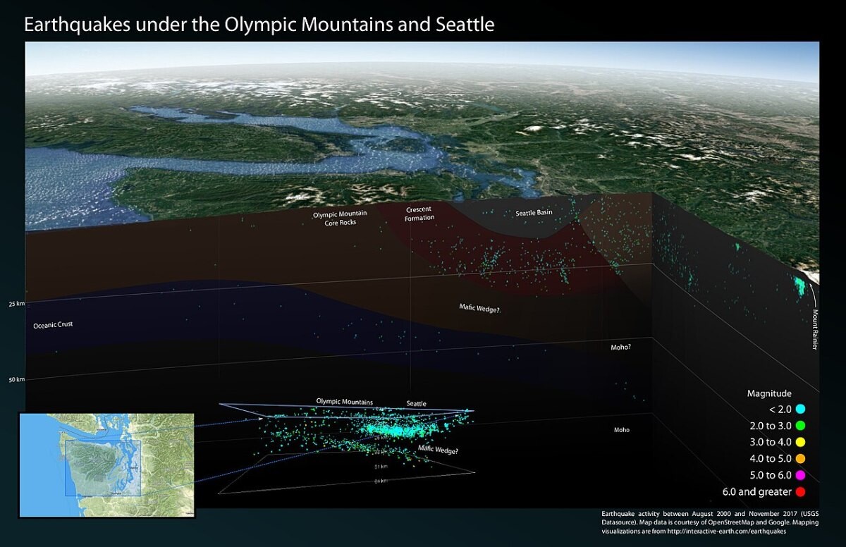
Off the BC coast, the Juan de Fuca plate slides beneath North America. That Cascadia subduction zone can produce magnitude 9 earthquakes every 200 to 800 years; the last one struck in January 1700. Risk rises as cities grow on top of that hazard, which is why NRCan and the GEM Foundation built a national seismic risk model (Earthquake Spectra, 2023).
In Western Canada, people also cause quakes. A peer-reviewed study (Atkinson et al., Seismological Research Letters, 2016) found that about 62% of magnitude 3+ quakes in the Western Canada Sedimentary Basin in 2010-2015 were linked to hydraulic fracturing and 31% to wastewater disposal. The Insurance Bureau of Canada notes that Canada is the only G7 country with significant earthquake risk and no government-backed insurance backstop.
Recent cases
- 6 December 2025: an M7.0 earthquake on the southern Yukon-Alaska border shakes items off walls and shelves across western Yukon; no structural damage is reported (Earthquakes Canada).
- 27 November 2025: Canada activates earthquake early warning in Quebec and Ontario with more than 200 sensors (NRCan).
- 21 February 2025: an M4.7 quake near Sechelt, BC, is felt as far as Prince George and triggers an early-warning alert (Earthquakes Canada).
Press releases and official reports, 2023–2026
Five key releases a year for the last four years, newest first. Most come from federal departments and agencies, the Transportation Safety Board, Statistics Canada and provincial governments; a few news and trade reports are included where they are the clearest public record of an event. Releases from 2007–2022 are in the expandable list after 2023.
2026
- 17 Sep 2026CP24Earthquake shakes residents in Kootenays region of B.C.
- 18 Jun 2026Earthquakes CanadaEarthquake Details (2026-06-18)
- 19 May 2026IBCIBC outlines industry proposal for a national earthquake solution
- 14 Apr 2026Earthquakes CanadaEarthquake Details (2026-04-14)
- 1 Apr 2026Earthquakes CanadaEarthquake Details (2026-04-01)
2025
- 6 Dec 2025Earthquakes CanadaEarthquake Details (2025-12-06)
- 27 Nov 2025NRCanCanada activates Earthquake Early Warning System in Quebec and Ontario
- 20 Nov 2025IBCNew Report Shows 92% of British Columbians Face Earthquake Risk
- 4 Nov 2025IBCFederal government takes an important first step to protect Canadians from the impacts of earthquakes
- 21 Feb 2025Earthquakes CanadaEarthquake Details (2025-02-21)
2024
- 26 Sep 2024Earthquakes CanadaEarthquake Details (2024-09-26)
- 15 Sep 2024Earthquakes CanadaEarthquake Details (2024-09-15)
- 1 Sep 2024Earthquakes CanadaEarthquake Details (2024-09-01)
- 29 Aug 2024NRCanGovernments of Canada and British Columbia Highlight Earthquake Early Warning System Launched in Western Canada to Strengthen Ability to Respond to Earthquakes
- 24 Jun 2024Earthquakes CanadaEarthquake Details (2024-06-24)
2023
- 30 Dec 2023Earthquakes CanadaEarthquake Details (2023-12-30)
- 17 Dec 2023Earthquakes CanadaEarthquake Details (2023-12-17)
- 17 Sep 2023Earthquakes CanadaEarthquake Details (2023-09-17)
- 6 Aug 2023Earthquakes CanadaEarthquake Details (2023-08-06)
- 13 Apr 2023Earthquakes CanadaEarthquake Details (2023-04-13)
View 20 years of major Canadian earthquake reports (2007–2026)70 more from 2007–2022, up to five a year, newest first
2022
- 29 Nov 2022Earthquakes CanadaEarthquake Details (2022-11-29)
- 25 Nov 2022Earthquakes CanadaEarthquake Details (2022-11-25)
- 14 Nov 2022Earthquakes CanadaEarthquake Details (2022-11-14)
- 23 Apr 2022Earthquakes CanadaEarthquake Details (2022-04-23)
- 10 Jan 2022Earthquakes CanadaEarthquake Details (2022-01-10)
2021
- 17 Dec 2021Earthquakes CanadaEarthquake Details (2021-12-17)
- 27 Aug 2021Earthquakes CanadaEarthquake Details (2021-08-27)
- 10 Jun 2021Earthquakes CanadaEarthquake Details (2021-06-10)
- 17 May 2021Earthquakes CanadaEarthquake Details (2021-05-17)
- 29 Mar 2021Earthquakes CanadaEarthquake Details (2021-03-29)
2020
- 4 Nov 2020Earthquakes CanadaEarthquake Details (2020-11-04)
- 22 Jul 2020Earthquakes CanadaEarthquake Details (2020-07-22)
- 9 May 2020Earthquakes CanadaEarthquake Details (2020-05-09)
- 6 May 2020Earthquakes CanadaEarthquake Details (2020-05-06)
- 24 Jan 2020Earthquakes CanadaEarthquake Details (2020-01-24)
2019
- 24 Dec 2019Earthquakes CanadaEarthquake Details (2019-12-24)
- 29 Aug 2019Earthquakes CanadaEarthquake Details (2019-08-29)
- 15 Jul 2019Earthquakes CanadaEarthquake Details (2019-07-15)
- 3 Jul 2019Earthquakes CanadaEarthquake Details (2019-07-03)
- 10 Jan 2019Earthquakes CanadaEarthquake Details (2019-01-10)
2018
- 19 Nov 2018Earthquakes CanadaEarthquake Details (2018-11-19)
- 21 Oct 2018Earthquakes CanadaEarthquake Details (2018-10-21)
- 19 Apr 2018Earthquakes CanadaEarthquake Details (2018-04-19)
- 23 Jan 2018Earthquakes CanadaEarthquake Details (2018-01-23)
- 4 Jan 2018Earthquakes CanadaEarthquake Details (2018-01-04)
2017
- 28 Dec 2017Earthquakes CanadaEarthquake Details (2017-12-28)
- 22 Dec 2017Earthquakes CanadaEarthquake Details (2017-12-22)
- 5 Sep 2017Earthquakes CanadaEarthquake Details (2017-09-05)
- 1 May 2017Earthquakes CanadaEarthquake Details (2017-05-01)
- 8 Jan 2017Earthquakes CanadaEarthquake Details (2017-01-08)
2016
- 16 Sep 2016Earthquakes CanadaEarthquake Details (2016-09-16)
- 10 Sep 2016Earthquakes CanadaEarthquake Details (2016-09-10)
- 18 Mar 2016Earthquakes CanadaEarthquake Details (2016-03-18)
- 2 Feb 2016Earthquakes CanadaEarthquake Details (2016-02-02)
- 12 Jan 2016Earthquakes CanadaEarthquake Details (2016-01-12)
2015
- 29 Dec 2015Earthquakes CanadaEarthquake Details (2015-12-29)
- 15 Jul 2015Earthquakes CanadaEarthquake Details (2015-07-15)
- 13 Jun 2015Earthquakes CanadaEarthquake Details (2015-06-13)
- 22 Jan 2015Earthquakes CanadaEarthquake Details (2015-01-22)
- 7 Jan 2015Earthquakes CanadaEarthquake Details (2015-01-07)
2014
- 9 Aug 2014Earthquakes CanadaEarthquake Details (2014-08-09)
- 25 Jul 2014Earthquakes CanadaEarthquake Details (2014-07-25)
- 4 Jun 2014Earthquakes CanadaEarthquake Details (2014-06-04)
- 26 May 2014Earthquakes CanadaEarthquake Details (2014-05-26)
- 23 Apr 2014Earthquakes CanadaEarthquake Details (2014-04-23)
2013
- 21 Sep 2013Earthquakes CanadaEarthquake Details (2013-09-21)
- 3 Sep 2013Earthquakes CanadaEarthquake Details (2013-09-03)
- 4 Aug 2013Earthquakes CanadaEarthquake Details (2013-08-04)
- 17 May 2013Earthquakes CanadaEarthquake Details (2013-05-17)
- 4 Jan 2013Earthquakes CanadaEarthquake Details (2013-01-04)
2012
- 12 Dec 2012Earthquakes CanadaEarthquake Details (2012-12-12)
- 7 Nov 2012Earthquakes CanadaEarthquake Details (2012-11-07)
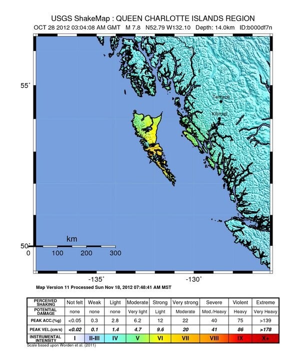
- 28 Oct 2012Earthquakes CanadaEarthquake Details (2012-10-28)
- 27 Oct 2012Earthquakes CanadaEarthquake Details (2012-10-27)
- 10 Oct 2012Earthquakes CanadaEarthquake Details (2012-10-10)
2011
- 25 Sep 2011Earthquakes CanadaEarthquake Details (2011-09-25)
- 18 Sep 2011Earthquakes CanadaEarthquake Details (2011-09-18)
- 9 Sep 2011Earthquakes CanadaEarthquake Details (2011-09-09)
- 23 Aug 2011Earthquakes CanadaEarthquake Details (2011-08-23)
- 16 Mar 2011Earthquakes CanadaEarthquake Details (2011-03-16)
2010
- 7 Aug 2010Earthquakes CanadaEarthquake Details (2010-08-07)
- 23 Jul 2010Earthquakes CanadaEarthquake Details (2010-07-23)
- 19 Jul 2010Earthquakes CanadaEarthquake Details (2010-07-19)
- 23 Jun 2010Earthquakes CanadaEarthquake Details (2010-06-23)
- 27 Feb 2010Earthquakes CanadaEarthquake Details (2010-02-27)
2009
- 17 Nov 2009Earthquakes CanadaEarthquake Details (2009-11-17)
- 21 Jul 2009Earthquakes CanadaEarthquake Details (2009-07-21)
- 7 Jul 2009Earthquakes CanadaEarthquake Details (2009-07-07)
- 1 Jul 2009Earthquakes CanadaEarthquake Details (2009-07-01)
- 7 Jun 2009Earthquakes CanadaEarthquake Details (2009-06-07)
Some early years list fewer than five items. Many Canadian government releases from that period are no longer online at their original addresses, and we only list items we could open and check. Where a page shows no date, the date comes from the release address or the publisher’s own index.
Photo list
How this page is built. Figures come from the official statistical releases linked above; where agencies publish provisional numbers we say so, because they are revised. Canadian statistics are often collected by provinces and territories, and some national series run several years behind, so we say which area and year each figure covers. Photos are public-domain or Creative Commons images credited in each caption; file photos are illustrative and are not from the events described unless the caption says so. This page tracks trends and is not personal safety, medical, legal or financial advice.